The Nakasendō was the inland highway of the Edo period (1603–1868), running from Nihonbashi in Edo, today's Tokyo, through the mountains of central Japan to Kyoto. One of its hardest climbs was the Usui Pass, on the border of today's Gunma and Nagano prefectures, and at Yokokawa, at the eastern foot of the pass, the shogunate kept a barrier that checked travelers going into and out of the Kantō region.
Sixty-nine stations through the mountains
The Nakasendō was one of the five highways that started from Edo and were run directly by the shogunate. The Tōkaidō followed the coast. The Nakasendō, second in importance to the Tōkaidō, went between the mountains in the middle of Honshu.
It had 67 post stations, from Itabashi, northwest of Edo, to Moriyama in Ōmi Province. At the next station, Kusatsu, it joined the Tōkaidō, and with Kusatsu and Ōtsu added it was counted as 69 stations. From Nihonbashi to the Sanjō Bridge in Kyoto was about 530 kilometers, about 38 kilometers more than by the Tōkaidō.
The Nakasendō was less crowded than the Tōkaidō, meals and lodging cost less, and it had no sea crossings and no rivers where travelers were held up by high water. What it had were passes: Usui first, then Wada, Shiojiri and Torii.
Lords, princesses and pilgrims
Thirty daimyo, the feudal lords of the provinces, used the Nakasendō for their required journeys to and from Edo, against 146 on the Tōkaidō. Princesses from Kyoto who married into the shogun's family often came by the Nakasendō too.
In 1861 Princess Kazunomiya, a daughter of Emperor Ninkō, traveled the Nakasendō to Edo to marry the fourteenth shogun, Tokugawa Iemochi. Her procession crossed the Usui Pass and spent a night at the post town of Sakamoto. Counting the party sent from Edo to meet it, the procession is estimated at about 10,000 people. A detour with a gentler slope was cut on the pass for the procession, and that detour is known as the Kazunomiya road.
Pilgrims on their way to the temple Zenkōji crossed the Usui Pass as well.
The barrier at Yokokawa
The barrier of the Nakasendō was set up on the Usui Pass in 1590 on Tokugawa Ieyasu's orders and moved down to Yokokawa in 1623. Its work is summed up in the phrase iri-deppō ni de-onna, "guns coming in and women going out." The wives of the daimyo were made to live in Edo as hostages, and the barrier watched for any wife escaping to her home province and for firearms being carried toward Edo. A gun needed a certificate from the shogun's senior councillors, and a woman needed a travel permit.
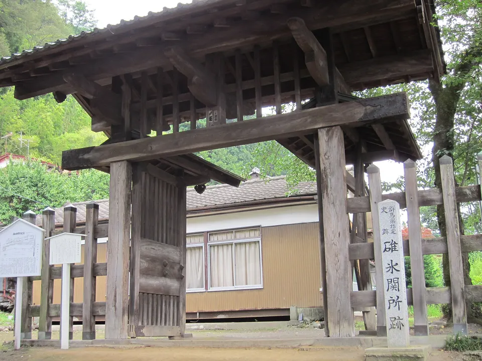
The barrier had an east gate and a west gate about 95 meters apart, and the highway ran between the two gates. The shogunate guarded the west gate and the Annaka domain, which administered the barrier, guarded the east gate.
Close to the barrier in Yokokawa stood a chaya honjin, a rest house for daimyo and court nobles, where lords arriving from Edo are thought to have put their dress in order before the barrier.
Sakamoto and the climb
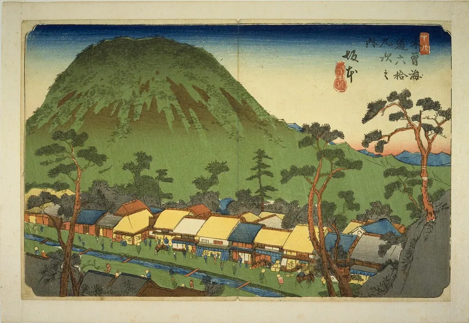
Sakamoto, the seventeenth station from Edo, was laid out to a plan at the foot of the pass. The town was about 700 meters long, with 80 houses on each side of the road and a water channel down the middle. Keisai Eisen's woodblock print of Sakamoto shows the channel. Two of the 160 houses were honjin, the lodgings for daimyo, court nobles and shogunate officials, and the town had 53 inns.
From Sakamoto the road followed a ridge up to the pass, a route fixed in 1602. The old road leaves today's national highway at 512 meters above sea level and reaches 1,197 meters in front of the shrine at the top, a rise of about 685 meters. Sakamoto and Karuizawa, the next station, were about 12 kilometers apart, and travelers rested at teahouses at two places in the mountains between them. The four teahouses near the summit of Mount Haneishi have left their stone walls.
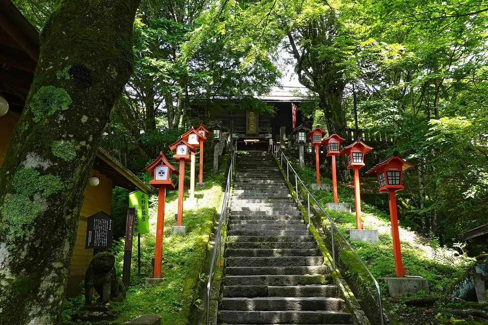
On the pass stands the Kumano Shrine, whose main sanctuary straddles the border between Gunma and Nagano. Beyond the pass the Nakasendō ran through three post towns, Karuizawa, Kutsukake and Oiwake.
The samurai who ran to the pass
In 1855 the lord of Annaka, Itakura Katsuakira, had his retainers run from Annaka Castle west along the Nakasendō to the Kumano Shrine on the Usui Pass, a distance of more than seven ri (one ri is about 3.9 kilometers), and had the order of their arrival recorded. The run is called the Ansei tōashi, the long-distance run of the Ansei era. The record book was found in 1955 in a teahouse on the pass. It lists 96 retainers by name, with the time each arrived and the place he took.
The city of Annaka calls the run the oldest marathon in Japan. The run was revived in 1975 as a race held every May, with runners in samurai costume.
After the barrier
The barrier was abolished in 1869. In 1883 a new road opened about 3 kilometers south of the old one, crossing the pass at 956 meters, and it is now National Route 18. On October 15, 1885, the railway from Takasaki reached Yokokawa, and Oginoya began business at Yokokawa Station that day. A horse tramway ran between Yokokawa and Karuizawa from September 1888, and in April 1893 the rack railway over the pass opened.
The old road over the pass stayed unpaved. The site of the barrier was made a historic site of Gunma Prefecture on January 14, 1955, and the east gate was rebuilt there in 1960. On March 10, 2025, the barrier site and about 8 kilometers of the old road, up to the Kumano Shrine, were added to the national historic site named Nakasendō, the first section of the road in the Kantō region to be included.
On February 1, 1958, Oginoya put a new ekiben, a station bento, on sale at Yokokawa Station and named it Tōge no Kamameshi. Tōge is the Japanese word for a mountain pass.
References
- Kotobank, "Nakasendō"
- Kotobank, "Usui Barrier" (Usui no seki)
- Kotobank, "Usui Pass"
- Kotobank, "Iri-deppō ni de-onna"
- Kotobank, "Sakamoto-juku"
- Kotobank, "Gokaidō" (the five highways)
- Kotobank, "Site of the Usui Barrier"
- Kotobank, "Kumano Kōtai Shrine"
- Kotobank, "Kazunomiya"
- Annaka City, "Site of the Usui Barrier"
- Annaka City, "The Nakasendō over the Usui Pass becomes a national historic site"
- Annaka City newsletter, June 1, 2025, feature on the Nakasendō over the Usui Pass (PDF)
- Annaka City Board of Education, survey report for the Nakasendō over the Usui Pass, March 2022 (PDF)
- Annaka City, "Cultural properties in the city"
- Annaka City, "The 52nd Ansei Tōashi Samurai Marathon" (PDF)
- Gunma Prefectural Museum of History, exhibition on the Annaka domain
- Oginoya, chronology
Image credits (resized for display):
- Keisai Eisen / Wikimedia Commons, Public domain
- Saigen Jiro / Wikimedia Commons, Public domain, 2011
- 663highland / Wikimedia Commons, CC BY-SA 4.0, 2024